The Intracoastal Waterway, usually just called the ICW, covers the area between Norfolk, VA and Key West, FL. In fact, Norfolk is mile 0, and you can travel all 1,243 miles south. There are even physical "mile markers" stuck near the shore that you'll see at some places. What began as a project many years ago to promote safe passage for commercial vessels has today become a virtual blue highway for sailors.
Traffic Once underway on the ICW, you'll find that you're sharing the water with an array of different boats. The commercial traffic that we encounter is an occasional tug and barge. US Coast Guard workboats are commonly seen maintaining the aids to navigation along the way. Casino boats, tour boats or commercial fishermen heading to or from a nearby inlet round out the fleet. If you meet commercial traffic in a narrow stretch of the ICW and are unsure of their intentions, a quick call on VHF Channel 16 or 13 will help you coordinate a safe passage. The volume of traffic on the ICW peaks in the spring during the months of April and May, then again in the fall months of October and November. These are the months of seasonal migration during which thousands of boats travel to and from various winter destinations. New friendships are easily made along the way. You'll find yourself continually running into the same boats time and time again at fuel stops, anchorages, and marinas. Happy-hour gatherings and the sharing of information soon become a way of life. Veteran cruisers often return to the ICW year after year just to be part of the pure fun and friendship that accompanies those who transit this route.
Anchorages and Docking Budget-minded cruisers can find safe, interesting and free anchorages the entire length of the ICW. Lots of cruisers have traveled the ICW for years and never paid a single cent in dockage fees. But saving money isn't the only reason to anchor out. The anchorages along the ICW vary greatly from one area to the next. One night you may find yourself in a beautiful remote spot being entertained for hours by an alligator stalking a shore bird for his supper. The next night you'll enjoy the twinkling light of a quaint waterfront town while live music drifts lazily across the waters from a local watering hole. Then, sometimes you're forced to anchor in less desirable spots where you're surrounded by brightly lit condominiums and the drone of heavy traffic from a nearby road. The shallower your draft, the more options you will have - Makai needs 5 1/2'. More than once we have arrived at an anchorage recommended by a guidebook or friends only to find it crowded with boats. Then when we check the chart, we find that there is a perfectly suitable place just around the corner, but because it's not listed in the guidebook, it's totally empty. We've never been unable to find a spot with room to anchor for the night on the ICW. There are many cruisers along the way who prefer to tie up each night, and some who just like to treat themselves every once in awhile. For these folks there are a large number of marinas along the entire route. Transient dockage fees down the ICW range from as low as $1.00 per foot per night to several dollars down in the Miami area.
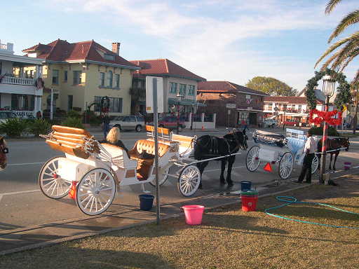
Bridges and Locks An important part transiting the ICW involves the passing under or through many bridges. Both fixed and opening bridges need to be approached with certain knowledge and respect. The fixed high-rise bridges on the Waterway are designed to provide a free vertical clearance of 65 feet. The actual bridge clearance however can differ from its design and from what's shown on your chart. Tides, wind, and even rainfall can all affect the actual clearance of a fixed bridge. It's common to see bridge clearance gauges that indicate less than the intended 65 feet. Boats with tall masts need to approach high-rise bridges carefully and proceed underneath only after confirming that the rig will fit. The opening of bridges on the ICW are as varied as the route itself. You'll encounter swing bridges, bascule bridges, and lift bridges. Some of the bridges, like the Bridge of Lions in St. Augustine, FL, are literal works of art. Others are just boring steel structures performing a function without any reward or beauty. Many bridges open "On Demand", or "On Request" as bridge tenders prefer to say, but quite a few have restricted opening schedules. In metropolitan areas, high-traffic bridges often have restricted openings, or stay closed for several hours to accommodate morning and afternoon rush hour traffic. Other bridges along the route may open only on the hour and half-hour, every 20 minutes, or sometimes every 15 minutes. Knowing the name and opening schedule of an upcoming bridge is extremely important for your trip to run smoothly. As bridge names are not always posted on bridges, nor are they always found on your chart, make sure the guidebook you have includes information about all opening bridges. I keep a handy waterproof sheet with us in the cockpit that lists the names and opening schedules of all ICW bridges by mile marker.The VHF frequency to use for requesting a bridge opening is either Channel 13 or 9 depending upon the state. Most bridge tenders prefer that you request your opening when you are within a quarter mile of the bridge. State highway departments like to build shorter rather than longer bridges whenever possible to save money. As a result, bridges are often positioned at the narrowest point for a given body of water. The positioning of these bridges sometimes results in exciting times for us boaters, as these areas of constricted water can carry swift currents and sometimes strong and gusty winds. These combinations require a diligent hand on the wheel when approaching both fixed and opening bridges. A dangerous situation can quickly unfold approaching a bridge in a narrow cut with a following current. With this in mind, it's important to closely note other boat traffic in and around a bridge, and closely monitor your radio as you approach. You may need to yield to another boat that needs room or find that you need additional pace yourself to safely maneuver within the channel. There are very few locks on the ICW. If you take the main (eastern) route south, there is a single lock at Great Bridge, VA which is easily entered and only takes a few minutes of lock time before it's done. If you choose the route through the Dismal Swamp, there is a lock at each end of the canal. All of these locks are simple and straightforward with no swirling or rushing waters to worry about. And these locks can be a great place to chat a little face to face with other boats heading the same way. And as an alternative to the ICW, you can always jump out and go off shore!


.jpg)
